


C-MAP Boating

Deskripsi C-MAP Boating
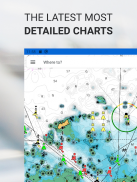
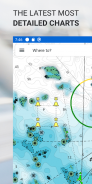
Aplikasi C-MAP® adalah teman yang sempurna bagi para pelaut rekreasi dan pecinta air. Tersedia di Ponsel, Tablet, atau PC, Anda selalu dapat mengakses grafik C-MAP terkini, di mana pun Anda berada.
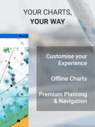
Dengan fitur lengkap, memungkinkan Anda menjelajahi, merencanakan, dan menyimpan Tempat Menarik dan Rute dari mana pun Anda berada, Aplikasi C-MAP adalah bantuan navigasi yang sempurna bagi pelaut yang cerdas.
Aplikasi C-MAP Termasuk:
- Penampil Grafik GRATIS
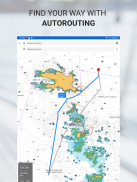
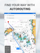
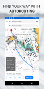
- Autorouting™ – temukan rute terbaik ke tempat favorit Anda
- Titik Arah Pribadi
- Perekaman Lagu
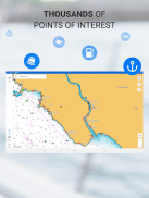
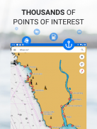
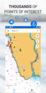
- Ribuan Tempat Menarik yang dimuat sebelumnya
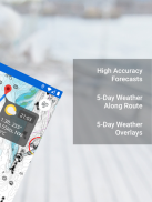
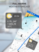
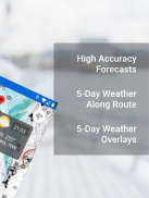
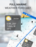
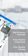
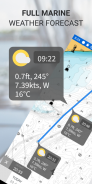
- Prakiraan Cuaca Laut
- Cuaca Sepanjang Rute
- Hamparan Cuaca
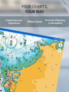
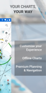
- Personalisasi Bagan
- Impor & Ekspor File GPX – bagikan Rute, Lintasan, atau Titik Arah Anda dengan teman
- Alat Ukur Jarak
Tingkatkan ke Premium untuk membuka fitur tambahan, termasuk:
- Fungsi GPS Penuh
- Unduhan Peta Offline
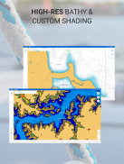
- MENGUNGKAPKAN Relief Berbayang
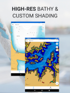
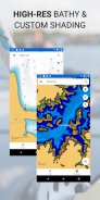
- Batimetri Resolusi Tinggi
- Bayangan Kedalaman Kustom
- Lalu Lintas AIS & C-MAP
Coba sebelum Anda membeli… Rasakan sendiri Aplikasi C-MAP Premium, dengan uji coba gratis selama 14 hari.
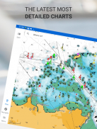
Aplikasi C-MAP diperbarui secara terus-menerus, memastikan peta terkini dan terkini selalu ada di ujung jari Anda.
Kebijakan pribadi:
https://appchart.c-map.com/privacy.html
Ketentuan Layanan
https://appchart.c-map.com/tos.html
C-MAP Boating - Versi 4.5.3
(02-07-2025)
C-MAP Boating - Informasi APK
Versi APK: 4.5.3Paket: com.isea.EmbarkVersi Terakhir dari C-MAP Boating
Versi lain


Aplikasi pada kategori yang sama


Anda juga mungkin suka...

Aplikasi pada kategori yang sama


